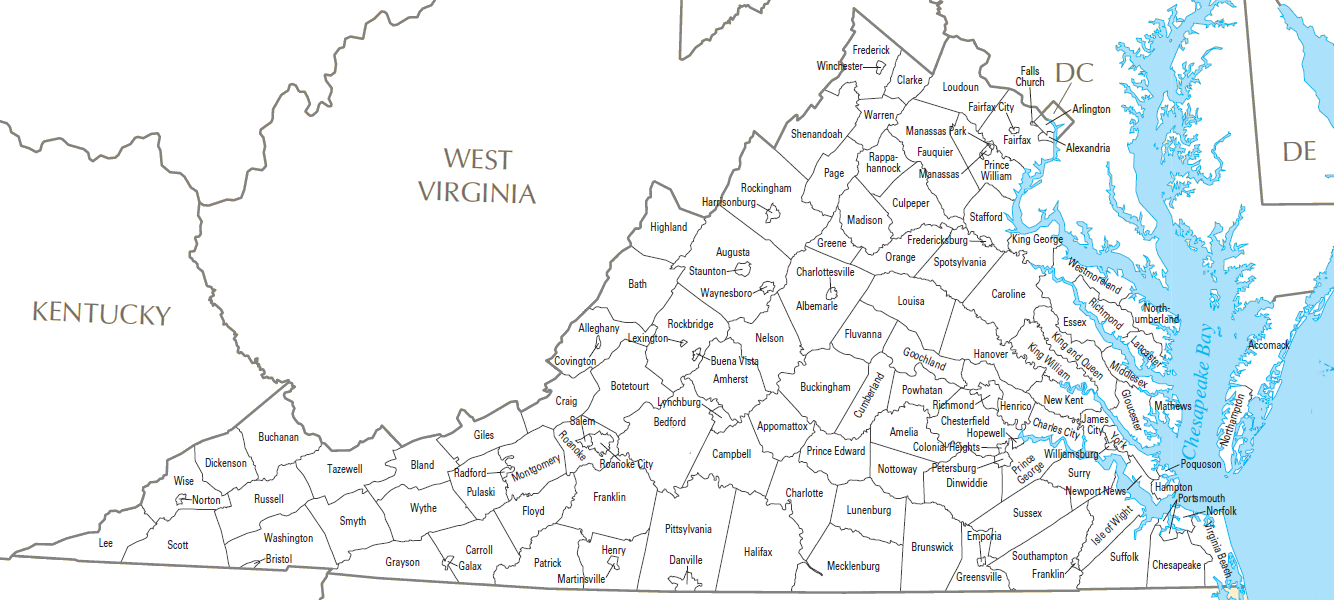
Virginia consists of 95 counties and 38 independent cities, creating a complex administrative landscape. Having a clear, printable reference for the counties of Virginia USA simplifies research, logistics, and regional planning for professionals and students alike.
Locating specific jurisdictions within the Commonwealth of Virginia requires more than just a standard map. Because Virginia utilizes a unique system where independent cities operate outside of county authority, a printed list or labeled map serves as a vital tool for verifying addresses, tax filings, and legal jurisdictions. This resource allows you to quickly cross-reference a city or town with its corresponding county, preventing common errors caused by overlapping names or ambiguous municipal boundaries.
Practical Applications for Mapping the Counties of Virginia USA
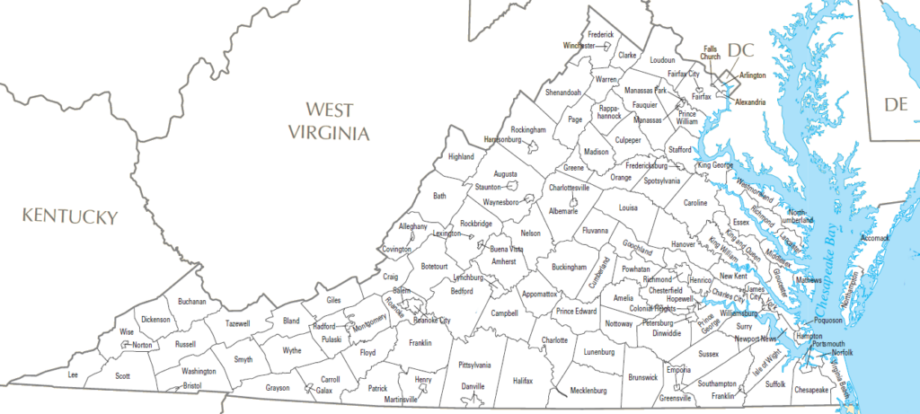
Genealogists and historians frequently rely on printed lists to track ancestral records across changing county lines. Since boundary lines in Virginia shifted significantly throughout the 18th and 19th centuries, having a static document helps in identifying which courthouse holds specific land deeds or vital records. By keeping a reference sheet handy, you can accurately pinpoint where to direct requests for genealogical documentation without guessing which administrative body currently holds the archives.
Logistics managers and delivery services use these resources to determine regional service areas and tax classifications. Virginia’s independent city structure often complicates shipping routes, as these urban centers function as distinct entities from the surrounding rural counties. A clear printable guide helps fleet operators and dispatchers categorize deliveries correctly, ensuring compliance with local transport regulations and accurate cost estimation for regional distribution.
Educational and Professional Use Cases
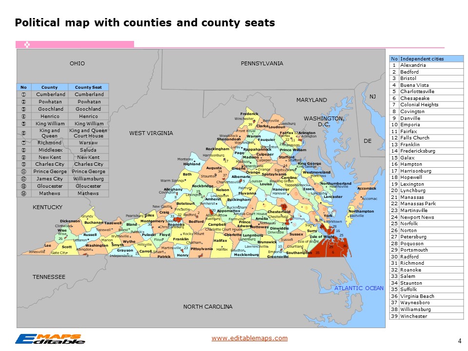
Educators often integrate these printables into social studies curricula to teach students about the unique administrative structure of the state. Having a physical worksheet allows students to color-code regions or identify the county seats, which provides a tactile way to memorize the geographic layout of the Commonwealth. This hands-on approach reinforces learning better than digital maps, as it allows for notes and highlights directly on the document during classroom activities.
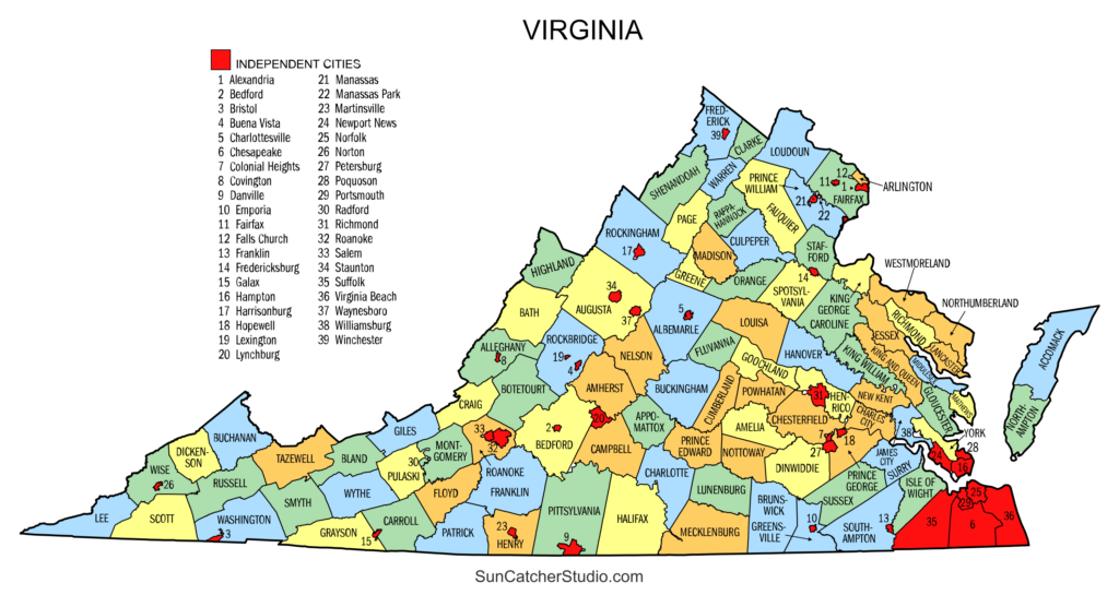
Real estate professionals and local government contractors use these references to manage zoning and permit applications. Because project requirements can vary dramatically between counties, confirming the exact jurisdiction of a property is the first step in any development process. Using a reliable printout ensures that your site plan aligns with the specific codes of the county in question, minimizing delays and administrative friction during the permitting phase of your project.
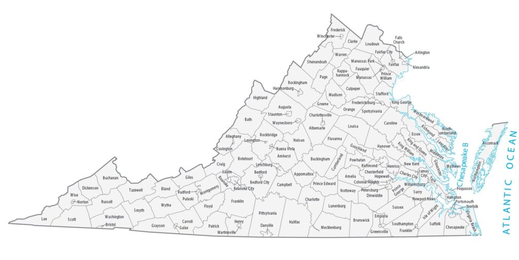
Maintaining an updated, printable reference is an efficient strategy for anyone dealing with Virginia records regularly. By organizing your workspace with these documents, you reduce the time spent searching online databases and minimize the risk of misidentifying a location. Whether for personal research or professional operations, a static, readable list remains the most reliable way to navigate the administrative geography of the region.